“#mypubliclandsroadtrip 2016: Search for Solitude, Bruneau Canyon Overlook” by mypubliclands is licensed under CC BY 2.0.
Idaho is known for its deep canyons, rugged wilderness, and open plains. While many visitors focus on famous spots like Hells Canyon or the Snake River, the Bruneau River Canyon in the southwest deserves just as much attention. Carved through volcanic rock over thousands of years, this canyon features dramatic walls, a hidden river corridor, and a remote landscape that few ever see in person. Rugged roads, sparse signs, and minimal facilities keep the crowds away, but for those who venture here, it’s easy to see why some call it the “Grand Canyon of Southwestern Idaho.”
The Bruneau River Canyon
“Bruneau-Jarbidge-Owyhee Rivers Wilderness” by mypubliclands is licensed under CC BY 2.0.
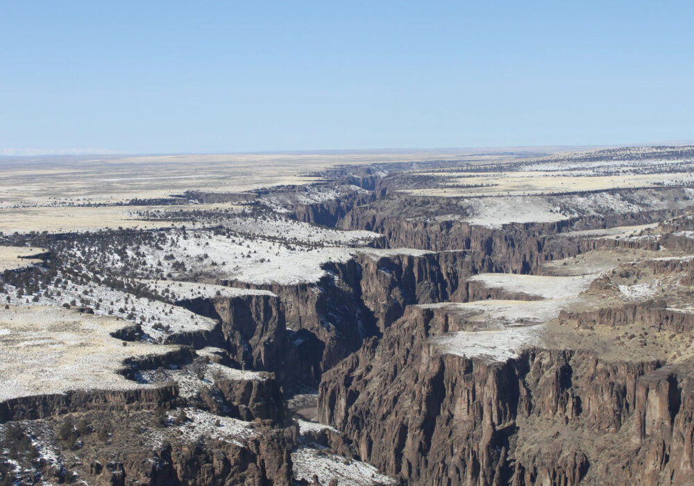
The Bruneau River originates in Nevada’s Jarbidge Mountains, then flows north into Idaho, meeting the Snake River near C. J. Strike Dam. On its path, it picks up tributaries like the Jarbidge River, carving a channel up to 1,000 feet deep in certain places. This network of gorges extends about 50 or 60 miles, ultimately merging with the Bruneau-Jarbidge Rivers Wilderness, where it meets more rugged tributaries.
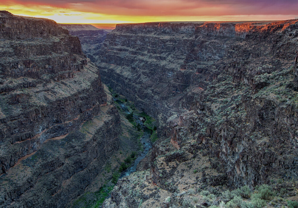
One of the best vantage points is the Bruneau Overlook, also called the Bruneau Canyon Overlook. From there, visitors stand on the canyon rim, looking 800 feet down to the river. Basalt and rhyolite cliffs dominate the horizon. The gorge measures about 1,300 feet across at that spot but narrows drastically in other areas, so narrow that the distance between canyon walls sometimes matches their depth.
Unlike many public lands in Idaho, the Bruneau River Canyon sees fewer travelers. Sparse, unpaved roads and a lack of major attractions keep visitors away. That isolation means those who make the trip often enjoy a sense of true solitude.
Geology: Basalt, Rhyolite, & River Erosion
“Bruneau-Jarbidge-Owyhee Rivers Wilderness” by mypubliclands is licensed under CC BY 2.0.
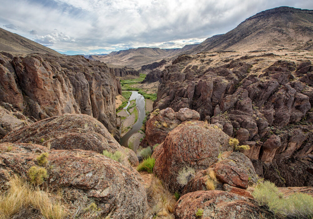
Southern Idaho’s landscape was shaped by volcanic eruptions and massive floods. Thick layers of basalt formed large sections of the region, and lighter-colored rhyolite appeared in certain zones. Over eons, the Snake River eroded its own deep valley, prompting waterways like the Bruneau to carve downward in unison. This process created steep canyons where basalt and rhyolite layers stand in stark relief, rising nearly a thousand feet above the water.
Though the Bonneville Flood around 14,500 years ago dramatically reshaped parts of Idaho, the Bruneau River Canyon owes its form largely to the slow grind of water cutting through volcanic rock. The result is a striking system of vertical walls and narrow bends, occasionally branching into side canyons. Visitors who make their way onto the rim often marvel at how sharply the canyon plunges from an otherwise flat plateau.
The Bruneau Overlook
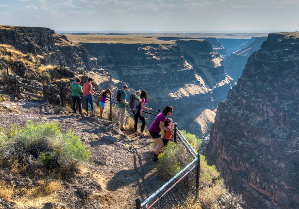
“Bruneau River Overlook” by BLMIdaho is licensed under CC BY 2.0.
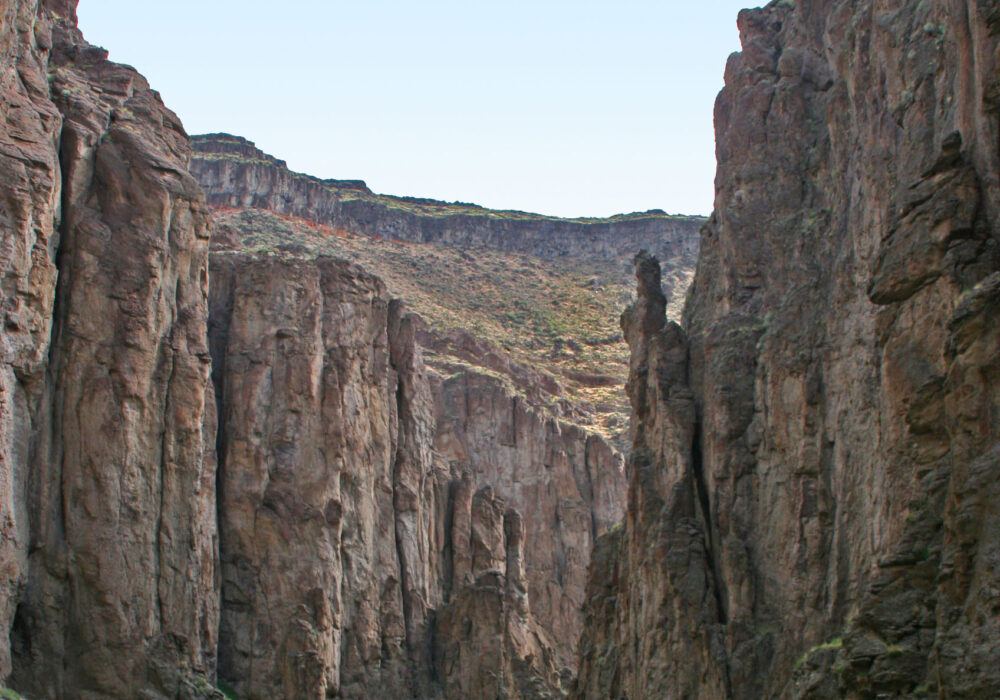
The main viewing area is the Bruneau Canyon Overlook, the only spot where a good road leads to a rim viewpoint. Here, you can park and walk up to a fence line, peering down 800 feet to see the river winding below. Basalt and rhyolite layers dominate the walls, with streaks of darker rock offset by the sagebrush on the rim. During morning or late afternoon, shadows deepen the canyon’s features, making for dramatic photography.
To reach this overlook, head to Bruneau on State Route 51, then go south on Hot Springs Road for about 15.5 miles. Look for the clearly marked turn to “Bruneau Canyon Overlook,” then drive another three miles on a graded gravel road. The first 12 miles are paved; the rest is gravel but manageable in dry conditions. Most standard vehicles do fine, but rain or mud might complicate the drive.
Once you arrive, you’ll see a small parking area, a vault toilet, and safety railings. Looking south, you’ll note how the Bruneau River’s gorge stretches for many miles. The rim-to-river drop is roughly 800 feet, and the canyon spans about 1,300 feet from edge to edge. Other overlooks exist in the region, but they typically require higher-clearance vehicles and a willingness to brave rough roads.
Hiking & the Wilderness Boundaries
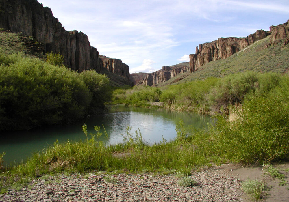
“Bruneau-Jarbidge-Owyhee Rivers Wilderness” by mypubliclands is licensed under CC BY 2.0.
Much of the Bruneau River canyon system lies inside the Bruneau-Jarbidge Rivers Wilderness. The canyon slopes, and often the canyon floor, are typically within this wilderness boundary. Motorized travel is prohibited except along specific cherrystem roads. Hiking, however, is allowed. Old Jeep routes sometimes double as informal trails, leading to canyon overlooks or partially into the gorge. Access can be challenging, and signage is limited. If you plan to hike, study detailed topographic maps and be realistic about your abilities. The canyon walls can be steep, and water sources may be scarce. If you do find water in the river, purify it, as local cattle grazing can lead to contamination.
Wildlife sightings can include bighorn sheep, mule deer, coyotes, cougars, and various birds of prey. The river itself sometimes hosts river otters. Be cautious around wildlife and store food properly if you plan an overnight stay. Campsites along the river are few, and the environment is dry, so carry enough drinking water. Summertime heat in these canyons can be relentless.
Boating the Bruneau River
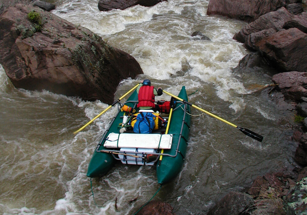
“Jarbidge Wild and Scenic River” by BLMIdaho is licensed under CC BY 2.0.
During spring snowmelt, the Bruneau River draws experienced whitewater enthusiasts. Typically peaking around May, flow rates can surge, creating thrilling rapids in the narrow gorge. Rafters and kayakers may launch at places like Bruneau Crossing, winding through tall canyon walls that block out direct sunlight in certain stretches. This short window of runoff can end quickly, so timing is everything.
Boating here is for skilled individuals who can handle remote conditions and potential Class IV rapids. Capsizing in such tight channels, flanked by high vertical walls, poses extra risks. Also, river flows can drop suddenly once the snowmelt subsides, so advanced planning is crucial. Trips may feel like a true wilderness experience, with no easy exits or maintained facilities.
Though less famous than Idaho’s other rivers, the Bruneau’s isolation and canyon scenery reward those willing to attempt it. Permits or specific rules might apply, depending on your put-in or route, so check with the Bureau of Land Management for up-to-date information.
The Look & Feel of the Canyon
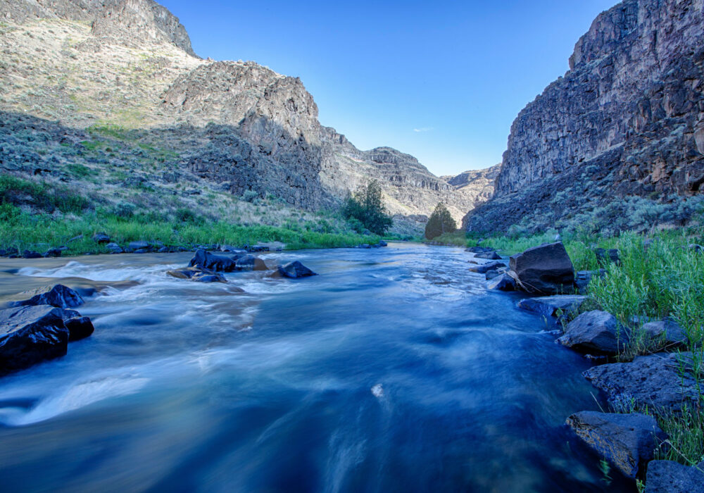
“Bruneau Wild and Scenic River” by mypubliclands is licensed under CC BY 2.0.
Standing on the rim, visitors often comment on how the canyon floor appears extremely far below, even though the plateau above looks unremarkable at first. This juxtaposition—the unassuming farmland or sagebrush plain giving way to a sudden chasm—makes the Bruneau River Canyon memorable. Dark basalt layers cap the edges, sometimes streaked with desert varnish or lichen. Lighter-toned rhyolite may appear in places, contrasting with the basalt. In the early morning or late afternoon, sun angles cast sharp shadows across every ridge.
Silence is another defining feature. With few roads or structures, the canyon environment is dominated by the sound of wind or the occasional distant rush of water. In spring, you might hear birds or see raptors gliding over the gorge. At other times, a hush settles over the rim, broken only by a breeze or the echo of a rockfall.
Getting to the Overlook
- From Bruneau Town: Head south on Hot Springs Road for 15.5 miles.
- Turn Right at the marked sign for “Bruneau Canyon Overlook.”
- Drive Three Miles on graded gravel. Use caution in wet conditions.
- Arrive at Overlook with a parking area, a vault toilet, and guardrails.
This straightforward route lets you witness the canyon’s grandeur without specialized vehicles. If you plan to explore further, be prepared for rough surfaces and minimal signage.
Practical Advice
“My Public Lands Summer Roadtrip: Idaho’s Owyhee and Bruneau-Jarbidge Wilderness” by mypubliclands is licensed under CC BY 2.0.
- Road Conditions: The roads can become treacherous when wet. A standard sedan might be fine in dry weather, but 4WD is recommended for exploring beyond the main overlook.
- Maps & GPS: Bring USGS topographic maps or a good GPS device. Phone signals are weak or nonexistent.
- Water & Food: Carry plenty, especially in warmer months, because the desert environment offers no reliable clean water sources.
- Extra Supplies: A spare tire and basic vehicle repair kit are essential. Let someone know your planned route.
- Camping: Only a few primitive spots exist near the river. Check for restrictions on motorized access. The wilderness area prohibits motor vehicles away from designated roads.
- Respect Wildlife: You might see bighorn sheep, deer, or predators. Keep your distance and store food securely.
Why the Bruneau River Canyon is a Beautiful Place to Visit in Idaho
“#mypubliclandsroadtrip 2016: Search for Solitude, Bruneau Canyon Overlook” by mypubliclands is licensed under CC BY 2.0.
The Bruneau River Canyon presents a glimpse of Idaho’s untouched spaces. Its basalt and rhyolite walls plunge hundreds of feet, revealing a hidden river corridor with sparse crowds, if any at all. A short drive from the town of Bruneau takes you to an overlook that few outsiders know about but which rivals many of the region’s better-known viewpoints. The hush of the desert, the sudden drop in front of you, and the faint trace of water below combine to create a sense of awe.
This canyon’s isolation is part of its charm. Paved roads and tourism infrastructure haven’t tamed the Bruneau. You won’t find big visitor centers or paved walkways. Instead, you discover a raw wilderness that showcases geology in action: ancient volcanic rock cleaved open by a determined river. If you’re looking for a beautiful place to visit in Idaho that stands off the usual tourist path—where you can grasp the scale of nature’s artistry—Bruneau River Canyon rewards the trek.
In southwestern Idaho, where farmland meets the desert plain, this canyon emerges as a sharp reminder that nature’s forces shape the land more than human hands. For those willing to meet the challenge, the Bruneau Overlook or deeper canyon routes can leave lasting memories of how massive, quiet, and humbling the world can be.
Quick Facts About the Bruneau River Canyon
- Location: The canyon lies in southwestern Idaho, with its main overlook accessed near the small town of Bruneau on State Route 51.
- Depth: In parts, the gorge plunges about 800 to 1,000 feet from rim to river.
- Geology: Formed by the Bruneau River cutting through layers of basalt and rhyolite, the canyon reveals dramatic volcanic rock walls.
- Overlook: A single graded road leads to the Bruneau Canyon Overlook, the most accessible rim viewpoint, complete with a vault toilet and safety railings.
- Length: The canyon system stretches for roughly 50 to 60 miles, including tributaries like the Jarbidge River.
- Wilderness Area: Much of the canyon falls within the Bruneau-Jarbidge Rivers Wilderness, limiting motorized use and preserving the landscape’s wild character.
- Isolation: Roads beyond the overlook are often unpaved or rugged, requiring high-clearance or 4WD vehicles to reach more remote viewpoints.
- Wildlife: Bighorn sheep, cougars, deer, coyotes, and river otters inhabit the canyon environment, thriving in its secluded habitats.
- River Running: Experienced rafters tackle the Bruneau River during the spring runoff, taking advantage of a short window of favorable water flows.
- Rugged Adventure: Few visitors make the trip due to challenging road access, but those who do are rewarded with striking canyon vistas and near-total solitude.
Idaho’s Mammoth Cave
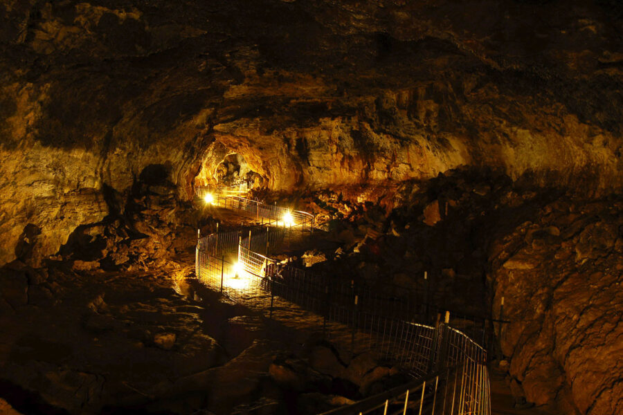
Planning a trip to Idaho? Don’t forget to put Idaho’s Mammoth Cave at the top of your list. As one of the most beautiful places to visit in Idaho, you can explore a unique and awe-inspiring underground landscape at your own personal pace with our self-guided tours. In addition to the cave, there are two privately owned museums of natural history on-site, the Shoshone Bird Museum and the Richard Arthur Olsen Museum featuring a wealth of exhibits that has earned them nickname “The Smithsonian of the Desert,” making it an unforgettable stop for the whole family.
Located eight miles north of Shoshone, Idaho, on Highway 75, Idaho’s Mammoth Cave will be open for seasonal tours from May – October, from 10 a.m. to 6 p.m. (with the last tours of the day going out at 5 p.m.), 7 days a week, including all major holidays. For more information, visit idahosmammothcave.com or call (208) 329-5382.
